
Urban Data
TOC
Our laboratory has an environment that allows us to use large-scale location data collected from smartphones. By leveraging this data and applying a wide range of techniques such as natural language processing and image processing, we conduct research on understanding urban structures, estimating people’s attributes, and estimating human mobility. These studies are highly significant, as they can serve as a foundation for fields such as urban planning and marketing.
Modeling
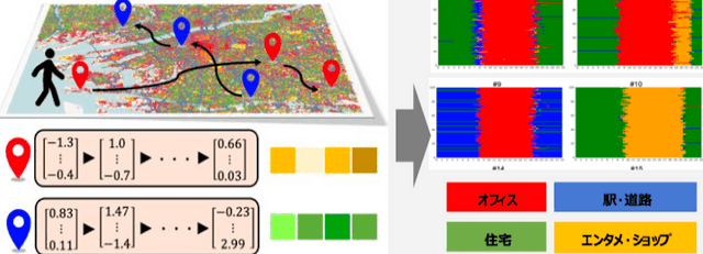
We model and group areas based on their usage patterns revealed through people’s stay information. In addition, we group trajectories with similar stay tendencies by analyzing time-series inter-area transitions.
GPS Data × Text Representations × Image Representations
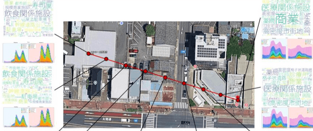
By integrating textual representations and text representations of satellite images with GPS-based urban mobility data, we conduct multimodal urban analysis. The figure on the left visualizes the linkage between spatial coordinates, time-dependent stay patterns, and related keywords associated with POIs (Points of Interest). Key technologies used in this research include Sentence-BERT, Vision Transformers, and multimodal LLMs.
Collection and Utilization of “Local Knowledge”

We believe that subjective, locally grounded information—often not available on the internet—is valuable for understanding regions. Accordingly, we are conducting research toward the realization of a framework that enables the continuous collection and utilization of such local knowledge.